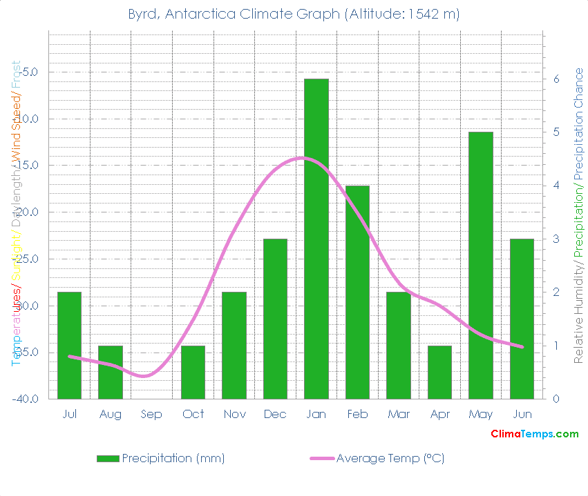
🌡️ The mean annual temperature is -28.1 degrees Celsius (-18.6 degrees Fahrenheit). See the temperatures page for a monthly breakdown and the fixed scale graph.
🐬 Average monthly temperatures vary by 22.7 °C (40.9°F). This indicates that the continentality type is continental, subtype subcontinental.
☔ Total annual precipitation averages 30 mm (1.2 inches) which is equivalent to 30 Litres/m² (0.74 Gallons/ft²).
Simply paste the following HTML code into your webpage. Please include a link back to this website. There is one in the following code already. Edit the width attribute to change the size of the graph if needed:
🐇Were you to burrow down through the centre of the Earth from Byrd you would pop up nearest to the climate station at Krenkel Polar (Isl), Russia where you would find a Tundra climate (Polar desert biome).
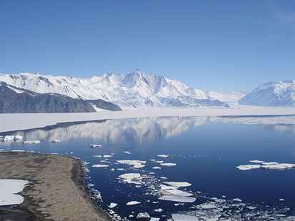
🌍Byrd, Antarctica is at 80°0'S, 119°31'W, 1542 m (5059 ft). Check the location on the map.
| Climate Variable | Jul | Aug | Sep | Oct | Nov | Dec | Jan | Feb | Mar | Apr | May | Jun | Annual | ||
|---|---|---|---|---|---|---|---|---|---|---|---|---|---|---|---|
| Average Temperature °C ( °F) | -35 (-32) | -36 (-33) | -37 (-35) | -32 (-25) | -22 (-7) | -15 (4) | -15 (6) | -20 (-4) | -28 (-18) | -30 (-22) | -33 (-28) | -34 (-30) | -28 (-19) | ||
| Average Precipitation mm (in) | 2 (0) | 1 (0) | 0 (0) | 1 (0) | 2 (0) | 3 (0) | 6 (0) | 4 (0) | 2 (0) | 1 (0) | 5 (0) | 3 (0) | 30 (1) | ||
| Average Daylight Hours/ Day | 0h 50' | 1h 21' | 11h 02' | 21h 49' | 0h 50' | 0h 50' | 0h 50' | 0h 27' | 14h 55' | 4h 02' | 0h 50' | 0h 50' | 12h 00' | ||
| Sun altitude at solar noon on the 21st day (°). | -10.3 | -1.8 | 9.6 | 20.9 | 30 | 33.4 | 29.8 | 20.4 | 9.6 | -1.9 | -10.3 | -13.4 | 9.7 |
Please take a moment to share a climate graph or simply the address:
Thank You, so much! ❤️